Price search results for Re01020678 Shipwrecks Of The Outer Banks Map Folded And Polybagged
⇑ click on img to enlarge
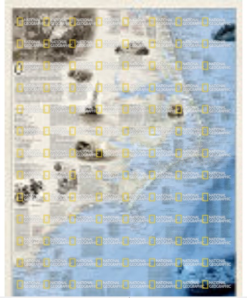
Re01020678 Shipwrecks Of The Outer Banks Map - Folded And Polybagged
Shipwrecks Of The Outer Banks Is A Stunning Map Illustrating More Than 1,550 Shipwrecks Of The Atlantic Coast From Cape Henry, Virginia To Cape Fear, North Carolina. The Shipwrecks Are Clearly Marked Atop Beautiful Bathymetric And Coastal Detail. Each Wreck Site Is Symbolized To Define The Class, Type And Name Of Vessel Accompanied By The Date Of Sinking. Icons Also Indicate Whether A Ship Was Lost Due To Conflict Or Natural Causes. Locations Of Lifesaving Stations And Lighthouses, Along With Navigational Beacons Are Also Marked. Bathymetric And Coastal Features Are Clearly Labeled. Captions And Drawings Are Used To Highlight Unique Historical Events. Whether A Naval Buff, Educator, Amateur Historian, Mariner Or Someone Simply Enamored With The Captivating Power Of The Sea, Shipwrecks Of The Outer Banks Would Make A Great Gift Or A Perfect Addition To Your Map Collection. Map Is Printed On Premium Quality Paper Stock, Folded, And Packaged In A Clear Plastic Bag. Net Proceeds From The Sale Of This Map Go To Support The Nonprofit Mission Of The National Geographic Society.
Add to Shopping List
Re01020678 Shipwrecks Of The Outer Banks Map - Folded And Polybagged Prices
The best price found is $25.22 from Unbeatable Sale.
| Where to buy | Price | Visit Store |
|---|---|---|
|
|
$25.22 | Visit Store |
