Price search results for Ti00000758 Manistee North Manistee National Forest trails Illustrated Map
⇑ click on img to enlarge
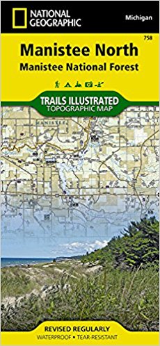
Ti00000758 Manistee North Manistee National Forest -trails Illustrated Map
Manistee National Forest Offers Year-round Opportunities For Outdoor Recreation In Michigans Northern Lower Peninsula. National Geographics Trails Illustrated Map Of Manistee North Combines Unmatched Detail With Helpful Information To Offer An Invaluable Tool For Making The Most Of Your Visit To This Scenic Region. Expertly Researched And Created In Partnership With Local Land Management Agencies, This Map Features Key Points Of Interest Including Ludington, William Mitchell, And Orchard Beach State Parks, Nordhouse Dunes Wilderness Area, And Portions Of Pine, Pere Marquette, Manistee, And Little Manistee Rivers. With Miles Of Hiking, Biking, Equestrian, Cross Country Ski, Snowmobile, Atv, And Motorcycle Trails Including North Country Trail And Michigan Cross Country Cycle Trail, This Map Can Guide You Off The Beaten Path And Back Again Whatever Your Mode Of Travel. Trail Use Designations And Mileage Between Intersections Are Clearly Marked. Designed With A Wide Range Of Visitors In Mind, This Map Features An Accurate Road Network, Campgrounds, Trailheads, Visitor Centers And Facilities, Park Regulations, Contact Information For Local Agencies, And Detailed Topography With Shaded Relief And Elevations. Many Recreation Features Are Noted As Well, Including Horse Camps, Interpretive Sites, Ski Areas, Disc Golf Courses, Beaches, Boat Ramps, Non-motorized River Access, And Areas For Fishing, Swimming, And Tubing. Every Trails Illustrated Map Is Printed On Backcountry Tough Waterproof, Tear-resistant Paper. A Full Utm Grid Is Printed On The Map To Aid With Gps Navigation. Other Features Found On This Map Include: Big Sable Point, Hamlin Lake, Manistee National Forest, Manistee River, Pere Marquette River, Portage Lake, Udell Hills.feturesmap Scale - 1:75,000sheet Size - 37.75 X 25.5 In.folded Size - 4.25 X 9.25 In.
Add to Shopping List
Ti00000758 Manistee North Manistee National Forest -trails Illustrated Map Prices
The best price found is $21.94 from Unbeatable Sale.
| Where to buy | Price | Visit Store |
|---|---|---|
|
|
$21.94 | Visit Store |
