Price search results for Ti00000759 Manistee South Manistee National Forest Trails Illustrated Map
⇑ click on img to enlarge
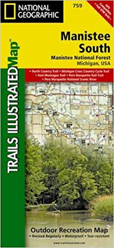
Ti00000759 Manistee South Manistee National Forest - Trails Illustrated Map
Explore The Many Recreational Opportunities Available Year-round In Michigans Northern Lower Peninsula With National Geographics Trails Illustrated Map Of Manistee South. Created In Partnership With Local Land Management Agencies, This Expertly Researched Map Delivers Unmatched Detail And Helpful Information For Experienced Outdoor Enthusiasts And Casual Visitors Alike. This Map Features Many Key Points Of Interest, Including Silver Lake, Hart-montague Trail, Newaygo, Muskegon, Mears, And Duck Lake State Parks, Pentwater River State Game Area, Portions Of The White, Pere Marquette, And Muskegon Rivers, And Hardy Dam Pond. The Manistee South Map Is An Invaluable Resource For Exploring The Miles Of Mapped Trails In The Region, Including The North Country, White Pine, And Pere Marquette Trails, And Michigan Cross Country Cycle Trail. Whether Youre Looking For A Hiking, Biking, Equestrian, Cross Country Ski, Snowmobile, Atv, Or Motorcycle Trail, Youll Find It Clearly Marked. Many Trails Are Shown With Mileage Between Intersections. Some Of The Many Recreation Features Noted Include Ski Areas, Beaches, Horse Camps, Interpretive Sites, Disc Golf Courses, Boat Ramps, Non-motorized River Access, And Areas For Fishing, Swimming, And Tubing. Helpful Material About Recreation Activities Available In The Region, Park Regulations, Orv Trail Signs, And Contact Information For Local Agencies Are Included As Well. Every Trails Illustrated Map Is Printed On Backcountry Tough Waterproof, Tear-resistant Paper. A Full Utm Grid Is Printed On The Map To Aid With Gps Navigation. Other Features Found On This Map Include: Big Rapids, Hardy Dam Pond, Lake Michigan, Little Muskegon River, Manistee National Forest, Muskegon, Muskegon River, Pentwater River, White River.feturesmap Scale - 1:75,000sheet Size - 37.75 X 25.5 In.folded Size - 4.25 X 9.25 In.
Add to Shopping List
Ti00000759 Manistee South Manistee National Forest - Trails Illustrated Map Prices
The best price found is $21.94 from Unbeatable Sale.
| Where to buy | Price | Visit Store |
|---|---|---|
|
|
$21.94 | Visit Store |
